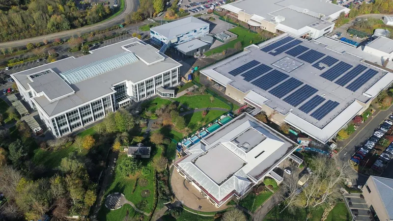
Trafford Park manufacturing and distribution
Single-occupier sheds across an estate begun in 1896, running from pre-war stock to 2024 build within a few hundred metres.

Alectrona
Commercial solar by areaA Trafford Park address is determined by Trafford Council, an M24 unit could be in any of four boroughs, an airport site with an Altrincham postal address is Manchester City Council, and a WN8 unit is a Wigan post town in West Lancashire borough. The connection application does not go to the operator most Yorkshire readers know either, and in one Lancashire postcode district it does not even go to the same operator throughout. Getting the borough, the plan and the distributor right at the outset is most of what separates a serious proposal from a quick one. We design, install and maintain solar over 50 kWp across Greater Manchester and Lancashire from Leeds, we have no base in the North West, and we have not completed an installation here.
Greater Manchester is ten separate planning authorities sharing one set of postal addresses, and the addresses do not follow the boundaries. The strongest single concentration of large commercial roof in the region carries a Manchester postal address and is determined by Trafford Council. The M24 outward code covers parts of four boroughs. Failsworth writes Manchester on its post and is administered by Oldham. An airport unit can show Altrincham on its letterhead and sit squarely inside Manchester City Council. None of that is trivia: it decides who you talk to before you apply, whose local plan your site sits under, and whose validation checklist your drawings have to satisfy.
North of the conurbation the same problem takes a different shape. Lancashire is two-tier for planning in most of its area and unitary in three places, so the borough, the district and the county can all have a hand in what happens on a roof, and one postcode district on the West Lancashire plain is split between two licensed network operators.
The same category error runs through the electrical side. The distribution network operator here is not the company a Yorkshire reader has dealt with, and above 50 kW its process is materially different from anything a domestic or small-commercial installer ever sees. This page sets out the boroughs, the operator and the connection route above 50 kWp, then goes estate by estate through what is actually on the roofs, from Trafford Park to the Fylde coast. We are based in Leeds, we have completed no installation anywhere in the North West, and nothing on this page is written to suggest otherwise.
Every design starts on the roof rather than on a satellite image. Our drone pilot is in-house, insured and qualified to A2 CofC and GVC standard, and flies the building to produce a measured 3D model of the real surface: parapets, plant decks, rooflight runs, the shading from a taller neighbour at the hour it matters, and the usable area once all of that has been taken out. On Greater Manchester stock that model does specific work, because an estate can hold a 1970s asbestos-cement roof and a 2024 composite deck within the same terrace and they are not the same project.
The model then feeds a PV*SOL simulation run against twelve months of your half-hourly consumption, which is what turns a roof area into a system with a generation figure, a self-consumption figure and an export position that can go in front of a board. Being an hour and a bit away is exactly why we fly rather than estimate: the flight has to be worth the journey, and a measured model answers the follow-up questions that would otherwise need a second visit.
Sites near Manchester Airport carry one extra step. Inside the aerodrome safeguarding zone the design package includes a glint and glare assessment and consultation with the airport operator, and that is scheduled at the start rather than discovered at validation.
Royal Mail postal geography and local government geography were drawn for different purposes and they disagree constantly here. Trafford Park is M17, which reads as Manchester, and it has been part of the Metropolitan Borough of Trafford since 1 April 1974, so Trafford Council determines every application on it. Salford Quays and MediaCityUK are M50 and belong to Salford City Council, with the MediaCityUK site itself straddling the Salford and Trafford boroughs. Eccles, Barton and Irlam are M30 and M44 and are Salford. Denton and Audenshaw are M34 and are Tameside. Failsworth is M35, a Manchester post town inside Oldham Council. Airport City and the World Freight Terminal are M90, in the Woodhouse Park and Ringway wards, which are Manchester City Council wards, so the Altrincham postal town shown on some of those addresses is a postal convention and nothing more.
Two outward codes deserve real caution rather than a footnote. M24 at Middleton reaches into Bury, Manchester, Oldham and Rochdale, so an M24 postcode on its own places a site in none of them and every M24 address has to be checked individually. OL16 spans Rochdale and Oldham, so it is not a synonym for Rochdale. Further north, OL12 runs from Rochdale into Rossendale, which is a different planning authority in a different county, and OL15 at Littleborough reaches into Calderdale and sits across the network operator boundary as well, which is why this page does not claim OL15 wholesale. In the west, WN8 is a Wigan post town and lies entirely in West Lancashire district. M60 is not a place at all: its sectors are non-geographic, designated for large-user and post-box mail, and it should never appear in a list of districts anybody claims to serve.
The plan layer sits on top of the borough layer. Nine of the ten Greater Manchester districts, being Bolton, Bury, Manchester, Oldham, Rochdale, Salford, Tameside, Trafford and Wigan, adopted the Places for Everyone joint development plan document, which took effect and became part of each of their statutory development plans on 21 March 2024. Stockport is not one of the nine. So the strategic policy backdrop for a site in Trafford and a site three miles away in Stockport is not the same document, and a proposal that assumes it is has started badly.
SP Electricity North West (formerly Electricity North West) is the distribution network operator for every borough and every Lancashire town on this page, and anything above 50 kWp connects to it under a G99 application. It is a different company from Northern Powergrid, which is the operator readers on the Yorkshire side of this site deal with, and the check takes seconds: the distributor identifier here is 16, and that is the first pair of digits of the MPAN printed on your supply invoice. Do the check per site rather than per portfolio, because on the West Lancashire plain a single postcode district can be split between this operator and SP Manweb. Every generation acceptance at 50 kW or above also sits inside its Queue Management process with project milestones attached, so the connection is a programme item from week one rather than a formality at the end.
The Fast Track route exists here and nothing at this scale can use it. It is confined to small generation installations with low-voltage modules whose intrinsic design capacity is 32 A or less, and whose aggregate registered capacity across all power generating modules is 60 A or less, using type-tested G98 or G99 inverters. Sixty amps three-phase at 230 V is roughly 41 kW, which sits below the point this business starts at, so every project we work on in this territory needs a full G99 application with network studies behind it. That last piece of arithmetic is ours rather than published, and it is worth stating because it is the cleanest line between work above 50 kWp and the domestic and small-commercial installations that only ever meet G98.
Above the threshold the requirements step up in bands, and knowing which band a site falls in changes the programme. Where an installation is greater than 150 kW and part four of the G99 standard application form cannot be completed at the point of applying, part four is required after acceptance and before energisation. Generation applications over 200 kW are requested to include a letter of authority from the land owner, which is requested rather than mandatory but is still a genuine gating item on a leased industrial unit. Over 1 MVA, part four has to be fully completed at application stage and both a letter of authority and heads of terms are required. At 1 MW and above the acceptance is submitted to National Grid, and the operator has been converting its grid supply point interfaces from the Statement of Works process to the Appendix G process.
Before any of that there is a pre-application step worth taking. The operator publishes an indicative heatmap of capacity at its primaries and bulk supply points, carrying its own caveat that it cannot replicate the detailed assessment made during a formal application, and it asks customers to open a dialogue before applying. We treat that as a shaping exercise rather than an answer. Where the network cannot support a connection as applied for, the choices are paying for reinforcement or accepting a managed connection, and both are better discovered in week one than in month six. Our guides on the G99 application, the connection queue and G100 export limitation set out what each stage asks for.
Trafford Park was bought for development in 1896 and became the first planned industrial estate in the world. It is still described as the largest in Europe, and Trafford Council’s own inward investment service puts more than 1,300 businesses and 35,000 employees on it. A study commissioned by that council identified potential to generate 147 GWh a year from rooftop and carport mounted panels across the park alone, set against 714,000 tonnes of carbon emitted there each year. Whatever else is arguable about the region, the roof area on this one estate is not.
What makes it interesting to design on is the era range. A single estate holds sheds put up before the Second World War, post-war manufacturing stock, 1980s and 1990s distribution units, and buildings finished in the last three years, often within a few hundred metres of each other. Two consequences follow. On anything predating 1999 the sheeting and the structure decide the project before the electrical design does, and asbestos cement is a survey question rather than an assumption; our guide on solar on older and asbestos roofs covers how that is handled. On the newest stock the opposite question applies.
The assumption that new build here arrives fully fitted does not survive contact with the evidence. The flagship speculative scheme at Ashburton Point, a 150,000 sq ft development of which the warehouse element is 135,000 sq ft, was delivered to BREEAM Excellent and EPC A+ with 17,000 sq ft of panels on the roof. That is roughly an eighth of the available plane. Developer arrays on schemes like this are sized to hit an EPC and a BREEAM credit rather than to fill the roof or to match whatever the eventual occupier turns out to draw. So a modern, well specified, already partly fitted building is frequently still an extension prospect above 50 kWp, and an occupier whose load has grown past the developer’s array is one of the better conversations available on the estate.
Two honest deductions. Much of the park is multi-let estate of small units where no single tenant’s weekday demand absorbs 50 kW, so the workable schemes there are landlord-side across a whole terrace. And a major fire broke out on the estate on 24 April 2026, with the affected buildings not established here, so any site record older than that date is worth confirming before it is relied on.
Single-occupier sheds across an estate begun in 1896, running from pre-war stock to 2024 build within a few hundred metres.
Irlam and Barton-upon-Irwell in Salford, including a 280,000 sq ft ambient contract logistics unit on the ship canal.
Sharston in M22, Roundthorn in M23 and the Openshaw urban logistics stock in M11, all inside the city boundary.
Modern big-box stock on M62 junction 21 at Rochdale, M60 junction 21 at Chadderton and M61 junction 4 at Bolton.
Extrusion, polymerisation, paint, tissue converting, laser cutting, aerospace composites and anodising across Blackburn, Darwen and Burnley.
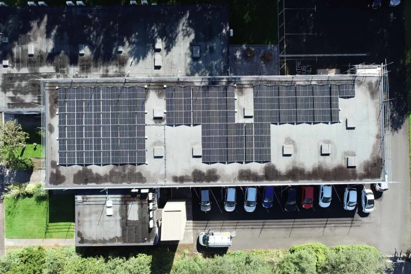
Strip out everything that is really Trafford or Salford and what remains inside Manchester City Council’s own boundary is a smaller market than the headline suggests, but a real one. In the south, Wythenshawe carries two established industrial areas. Sharston sits in M22, fronting Sharston Road and reached from junction 2 of the A560 where it links with the M56, about three miles from the airport, with the estate’s sectors named after letters of the Greek alphabet. The occupier mix is third-party logistics, waste handling and liquid polymer processing, plus a bus depot, and depot electrification is quietly the strongest load story on it: a fleet charging operation adds large, growing, partly daytime demand under a single roof and a single supply.
Roundthorn in M23 spans Southmoor Road, Floats Road, Ennis Close, Greeba Road and Ledson Road, with marketed accommodation from 5,496 to 45,283 sq ft and its own Metrolink stop. The units at the top of that range are straightforward candidates and the ones near the bottom are not, before rooflights and setbacks are deducted. One correction is worth making because the opposite is widely assumed: this is not a single-owner estate. At least two separate institutional owners hold interests across it, so ownership has to be established terrace by terrace before an estate-wide proposal is put to anybody.
East Manchester is the part a page titled Manchester can most credibly claim. The industrial estate on Crabtree Lane at Openshaw in M11 sits on Ashton New Road, under two miles from junction 23 of the M60 and a short walk from the Edge Lane Metrolink stop, and last-mile urban logistics on steel portal frames with profiled metal decks is the easiest structural case in the city for lightweight rail-mounted arrays. Central Park on Northampton Road in M40 is a different proposition: capacity for more than 1.4 million sq ft of mixed-use floorspace delivered from 2001, hosting Greater Manchester Police’s force headquarters and a divisional headquarters. Those are offices rather than sheds, so roof area per unit of demand is poor, but an emergency services headquarters runs a continuous high base load, so essentially every generated unit is used on site at the retail rate rather than exported at wholesale. Expect low hundreds of kWp per building and a public procurement route rather than a direct sale.
Salford’s useful roof stock sits west of the city, along the Manchester Ship Canal, and it gets better the further out you go. Northbank at Irlam in M44 occupies the former Irlam steelworks site on the north bank of the canal, across Irlam Wharf Road, Huntsman Drive, Brinell Drive and Omega Drive, and carries recent detached warehouse units of 40,638 and 65,604 sq ft alongside a good deal of 1980s and 1990s stock. Wine bottling operates on a large site in the town. Process operations of that kind run load through the working day, which is the demand shape a large array needs; a pure storage or parcel operation on the same estate may not be, and half-hourly data settles it rather than the building type.
At Barton-upon-Irwell in M30, roughly six miles west of the city centre, the intermodal freight terminal opened in 2016 with a built distribution unit of 280,000 sq ft, ambient contract logistics with 45,000 pallet spaces and 30 loading doors. A single occupier box of that size is one of the largest continuous roof planes in the conurbation. The constraint there is commercial rather than technical: a canal-side asset held by a major landowner and let to a national operator puts the decision with a corporate estates team, and further phases described in marketing are not built.
Salford Quays and MediaCityUK in M50 are the borough’s best known commercial address and among its least suitable rooftop stock, which is worth saying plainly. Broadcast and technical buildings carry very high, flat, round-the-clock demand on comparatively small roof footprints, and much of the flat roof that exists is taken by chillers and condensers. More decisively, the estate generates on site through its own energy centre and distributes over its own network under a separate operator, so a photovoltaic proposal there is not a straightforward G99 at all; it becomes a negotiation with the estate scheme about how new generation interacts with existing dispatch and with that network’s own connection terms. That is a slower and materially different project than a single-occupier shed.
One network fact belongs here because it is easy to misread. A live reinforcement programme centred on the Frederick Road substation is installing three 75-tonne 132,000-volt transformers and replacing older oil-filled underground cables at Agecroft and Duchy Road, with the cable work due to complete by November 2026 and the substation upgrades by December 2027. The stated driver is rising demand from electric vehicles and heat pumps. It is demand-led reinforcement, and demand-led reinforcement does not automatically create export headroom for generation, so treat it as good news about import capacity and neutral news about your export position.
M90 is the clearest single illustration of this page’s argument. The district covers Manchester Airport, Airport City and the World Freight Terminal, some of those addresses show Altrincham as the postal town, and the land sits in the Woodhouse Park and Ringway wards, both of which are Manchester City Council. So the determining authority is Manchester City Council, not Trafford, and a pre-application enquiry sent to the wrong council is a fortnight lost before anything technical has been discussed.
The building stock is genuinely good on paper. The large robotics fulfilment building at Sunbank Lane beside the M56 is a flat, high, largely daytime weighted load with a growing charging fleet attached. The freight terminal is single-storey handling sheds with flat and shallow-pitch roofs and round-the-clock operation, which means very high self-consumption and almost no reliance on export. Both are the sort of profile that makes an array above 50 kWp pay on imported units avoided rather than on units sold.
Then the aerodrome constraint, which is a real technical gate rather than a line in a risk register. A reflective array near an active airfield requires a glint and glare assessment, and inside the safeguarding zone it requires consultation with the airport operator. Apron-adjacent siting at the freight terminal makes both mandatory rather than advisory. That is workable, and it is modelled and consulted on rather than argued about, but it has to be in the programme from the start, along with the landlord position, because the airport operator controls the ground. One further honest point: occupiers of national scale at this location procure generation centrally, so the realistic route in is rarely a direct approach to the site.
Something consistent is happening on new stock across the outer boroughs, and it sets where the winnable work is. Recent Grade A estates are arriving with photovoltaics in the base specification. At Hollinwood Junction off junction 22 of the M60 the landlord lists solar panels among the estate amenities. At Broadway Central in Chadderton the estate page describes solar panels and charging points across the estate. In Stockport a new Grade A scheme at Bredbury publishes panels, heat pumps and charging on every unit. Read together, that is a market signal rather than a disappointment: the retrofit opportunity above 50 kWp is on the older and mid-age estates, and the competitive question is technical competence on an existing building rather than specifying panels on a new one.
The older and mid-age stock is where the volume sits, and each borough holds it in a different place. Chadderton in OL9 is Oldham’s main industrial concentration, a mature motorway-fronted estate about a mile from junction 21 of the M60 with the shallow-pitch portal-frame geometry this work suits, where at least one recent speculative pair publishes charging points and no solar. Rochdale’s is on the M62 itself. Bolton’s best roof is 2015 onwards off junctions 4 and 6 of the M61. Wigan’s strongest cases are food manufacturing and large-format distribution rather than estates. The covered-borough sections below take each in turn.
One engineering point cuts across all four, and it is the one most often discovered late. On a large modern shed the roof is rarely the binding constraint; the incoming supply is. A speculative warehouse of 369,251 sq ft at Broadway Green in Oldham publishes an incoming supply of 1 MVA against a roof plane that could physically carry several times that in panels. The design question on a building like that is not how many panels fit. It is what the connection will accept, whether export limitation under G100 is the answer, and whether a supply upgrade is worth its own programme. That is a question to ask in the first meeting, and it is answered from the meter and the application rather than from the roof.
Stockport is the one Greater Manchester borough that is not part of Places for Everyone, having withdrawn from its predecessor framework in December 2020, and that is not a technicality. It means the strategic development plan policies that apply to a site in Trafford or Salford do not apply here, and it means the borough is working through its own plan under external pressure. In September 2025 the Minister of State for Housing and Planning issued a local plan intervention directing the council to complete its Regulation 18 consultation by 24 December 2025 and to submit the plan for examination no later than 30 November 2026. The resulting draft plan runs to 2042 and proposes releasing 26 Green Belt sites capable of delivering 8,965 homes out of a stated overall supply of 16,400, after which more than 40 per cent of the borough would still be designated Green Belt. On a constrained borough that is the context any employment-land or ground-mount conversation sits in.
On the roofs, Bredbury at junction 25 of the M60 is the only part of the borough with real shed depth. Live listings there run to a single unit of 79,259 sq ft with 11.5 metre eaves under refurbishment, alongside units at 6 to 8.5 metre eaves, which indicates the shallow-pitch insulated metal deck geometry that suits a large array. Hazel Grove carries the borough’s heaviest single electrical load in an operating semiconductor wafer fab on Bramhall Moor Lane, where the demand case is unarguable and the roof is the problem: fab roofs are dense with chillers, scrubbers, gas lines and cleanroom air handling, and any work is governed by vibration and contamination control. The biscuit works on Wellington Road North has produced on the same site since 1917 and has a live capital programme running, so its roof is a multi-phase survey rather than one clean plane. At Cheadle Royal the honest answer is that the offices are weak on roof and the large surface car parks are strong on canopy, which matches a weekday office load precisely and pairs with charging.
Stockport also supplies the one thing this page cannot claim for itself: local evidence that arrays above 50 kWp get bought here. The council’s own trading company runs a waste and fleet depot at Bredbury carrying an array of a few hundred kilowatts across the main garage roof, a wash bay roof and car park canopies, with battery storage and a new substation, commissioned in 2023. A council leisure centre in the town centre carries a roof-mounted array of around 300 kWp installed the same year. Neither is ours, and neither is a prospect. They are proof that the borough’s public buyers have already specified this work at this scale, which is a more useful fact than a testimonial.
Lancashire does not organise itself into boroughs the way Greater Manchester does, at least not for this purpose. It organises itself into corridors, and the qualifying roof stock sits on them. The M65 runs east from junction 6 at Whitebirk through Blackburn, Darwen and Padiham to junction 9 at Burnley, and it is the manufacturing corridor: extrusion, polymerisation, paint mixing and filling, tissue converting, laser cutting and CNC machining, aerospace composites, automotive pressing and specialist anodising, all of which draw hard and steadily through the working day. Anodising in particular is among the most electrically intensive light-industrial processes there is, driven by DC rectifiers and heated baths.
The M6 and M61 spine is the second. The industrial cluster at junction 31A north-east of Preston, Buckshaw Village between junction 28 of the M6 and junction 8 of the M61, the vehicle assembly site at Farington and the food manufacturing estate at Moss Side hold the big-box and assembly stock. It is roof-rich and often load-light, so ambient distribution there pushes the case towards export while the manufacturing occupiers on the same estates are the better prospect. The third is Skelmersdale, which is a new town and reads like one: East and West Pimbo, East and West Gillibrands, Stanley Industrial Estate and the Statham Road corridor were laid out as a system rather than accreted over a century, and the borough’s qualifying roof is almost entirely in WN8.
Then the plain and the coast, which behave differently from all three. Growing, washing, grading, chilling and packing around Tarleton, Hesketh Bank and Burscough give one of the better self-consumption profiles in the county, with the caveat that glasshouses are not roof stock, so any assessment of the plain that counts glazed horticultural area as available roof is counting the wrong thing. On the Fylde coast the qualifying stock is narrow rather than absent, and it is worth naming precisely rather than padding: the airport business park cluster and Vicarage Lane in FY4, a food manufacturing site at Devonshire Road, two large factories at Fleetwood and a chemicals and polymer complex at Thornton-Cleveleys, with leasehold tenure dominant and most stock built between 1945 and 1990.
The operator boundary is not tidy in the west, and it is the one trap on this page that costs a fortnight rather than an afternoon. Ormskirk’s L39 district is split between two licensed operators: L39 1 tests as the operator this page names, while L39 5, L39 6 and L39 7 test as SP Manweb, and several other sectors are mixed. PR8 and PR9 are Sefton on a different operator again. At the far eastern edge, some outlying BD23 addresses beyond Skipton fall to this operator rather than to Northern Powergrid, which is the same trap running the other way. The rule is identical in every direction: confirm the distributor from the site’s own supply number rather than from the town, because an application sent to the wrong body starts the clock again. All four Skelmersdale sectors test as this operator without exception, which is not true of West Lancashire borough as a whole.
This operator also publishes more capacity data than most, and it is worth an hour before anything is committed. A heatmap tool, a workbook and a scrollable map give estimated spare capacity at every primary substation and bulk supply point across the 33 kV, 11 kV and 6.6 kV networks, broken down by technology, with generation, demand and storage headroom shown separately. Find the primary that feeds your site, then read the inverter-based generation row rather than the demand row.
Two warnings travel with it. The published values are the total capacity available to connections rather than the maximum size of any individual connection, which can be significantly less, and the estimate covers thermal loading, fault level and voltage step change while excluding 132 kV constraints and meshed networks. Some values are also clearly banded rather than measured, because the same headroom figure repeats identically across unrelated substations. Treat the tool as a screening step that tells you whether to worry, not as an answer, and enter into dialogue before applying. The finding that changes projects is usually on the other side of the meter, because generation headroom and demand headroom are different numbers and a primary with ample room for an array can have none at all for new load. That bears directly on any site planning fleet charging, electrified heat or new process plant alongside the array, and on battery storage, which is a separate application with its own answer.
One more published figure changes designs at sizing stage rather than after an offer arrives. The operator connects generation under 0.2 MW at low voltage as a rule, and between 0.2 MW and 7 MW at 11 kV or 6.6 kV, so a design pushing much beyond 200 kW should expect a high-voltage connection with the cost and programme that carries. Where the network cannot support what was applied for, its flexible product trades curtailment at constrained times for capacity sooner, which is the same trade our G100 export limitation guide sets out from the design side.
We are Leeds-based, we have no North West office, and we are not going to imply one. What we do have is a set of measured road distances, and they are shorter than most people expect. Rochdale’s big park at junction 21 of the M62 is roughly 31 miles, closer than parts of the Yorkshire coverage on this site, and Oldham’s estates run from about 31 to 38 miles. Salford is about 45, Trafford Park about 49 on the M621, M62 and M60, Stockport about 48 to 49, and Bolton 46 to 52 depending on the junction of the M61. Wigan is the far end at roughly 56 miles to the town and 61 to Ashton-in-Makerfield, though the eastern half of that borough is 9 to 14 miles nearer.
Those free-flow figures should not be planned against. The trans-Pennine section of the M62 and the M60 approaches are among the most congestion-prone stretches in the north of England, so a realistic door-to-door allowance is 1 hour 10 to 1 hour 45 for most of the conurbation, more in the morning and evening peaks and more again over the Pennine summit in winter. That is a judgement drawn from known conditions rather than a measured figure, and it is a real cost that falls on survey visits, snagging and any warranty callout rather than on the price of the equipment.
What it changes is how the work is organised rather than whether it is done. Every Greater Manchester site is a comfortable same-day return with several hours on the roof, so a survey is a planned visit rather than a drop-in. The drone flight matters more here than it does twenty minutes from the office, because a measured three-dimensional model means the second question gets answered from data rather than from a second crossing of the Pennines. Commissioning attendance and the first-summer check are diarised at the point of contract rather than assumed. And because there is no completed installation anywhere in the region to point at, the right thing to ask us for is the engineering: the survey, the model against your own consumption, the connection application and the design, not a local job count we do not have.
Manchester City Council determines applications for the City of Manchester and styles itself exactly that. Its own new local plan remains in preparation, so Places for Everyone together with the council’s existing adopted core strategy form the development plan for the city. The commercial roof stock inside that boundary is concentrated at the edges rather than the middle: Wythenshawe in M22 and M23, east Manchester in M11, M12 and M18, the mixed-use park in M40 north east of the centre, and the airport sites in M90.
The city core itself is the hardest part of the district to work in, and not for network reasons. Central Manchester carries extensive conservation area coverage, so the permitted development route for solar equipment on non-domestic premises cannot be assumed inside the core the way it can across an industrial estate. Listed buildings and their curtilage, scheduled monuments and article 2(3) land are all excepted from that route, and city-centre roofs are in any case flat plant decks competing with the array for the same limited area. Our planning permission guide sets out where the line falls.
Trafford Council is the determining authority for Trafford Park, Stretford, Urmston, Partington, Carrington and Altrincham, and it styles itself Trafford Council rather than by its formal metropolitan borough title. Beyond the park itself, M31 covers Partington and Carrington, where the joint plan’s largest development site sits: an allocation of roughly 1,200 hectares for housing and around 3.8 million sq ft of employment space, of which the built element today is a small completed scheme of about 211,000 sq ft including one unit close to 104,000 sq ft. That is a design-stage opportunity over the next decade rather than stock to retrofit now, and the difference is worth stating rather than blurring.
WA14 at Altrincham and Broadheath carries a multi-let industrial estate of about 206,121 sq ft on Atlantic Street, completed in 2024, where units run from roughly 2,000 sq ft up to about 41,500 sq ft and can be combined. The small trade units will not carry an array above 50 kWp on their own load; the largest will. WA14 also matters for a different reason: it is a Cheshire-facing postcode, which leads people to assume a different network operator, and it is not. The operator here is the same one as in central Manchester. Trafford General Hospital in M41 is the other large-load site in the borough, with the continuous demand profile that makes self-consumption near total and the multi-era roof estate that makes usable area, rather than demand, set the array size.
Salford City Council is the planning authority, and its development plan is its own development management policies and designations document, adopted by full Council on 18 January 2023 and replacing the saved policies of the earlier unitary development plan, alongside Places for Everyone. A further part of the local plan reached publication stage in 2026 and is not adopted, so it should not be described as policy. Salford is a member of the combined authority, and the combined authority does not determine rooftop or ground-mount applications; the city council does.
Coverage runs from M5 and M6 at Ordsall, Weaste and Pendleton through M27 at Swinton and Pendlebury, M30 at Eccles and Barton, M44 at Irlam and Cadishead, and M50 at the Quays. Note that M3 at Blackfriars and Greengate straddles the Manchester and Salford boundary and M28 spans Salford and Wigan, so both need checking per site. The mid-sized multi-let estates at Worsley and on Lynwell Road in Eccles are typical of the borough’s middle band: conventional single-storey portal frames where combined units clear the threshold, individual terraced units mostly do not, and roof rights, service-charge treatment and unexpired lease term decide feasibility before array design does. Salford Royal on Stott Lane is the large continuous load in the borough, with the procurement route to match.
Stockport Council brands itself that way while its corporate and planning-register name remains Stockport Metropolitan Borough Council. It is a unitary metropolitan borough, and as set out above it is the one Greater Manchester district outside the joint plan. Its network operator is the same as the rest of the conurbation, which is worth noting because the operator’s own registered office is in the town.
Beyond Bredbury, the borough divides in a way worth knowing before a visit. The Bird Hall Lane belt in SK3 at Cheadle Heath is a mixed verdict written down honestly: the detached industrial and warehouse buildings there are viable single-occupier candidates, while the three and four storey traditional buildings on the same road have a poor roof-to-floorspace ratio and fragmented metering and will rarely support a compliant array above 50 kWp on one supply. Hazel Grove in SK7 carries the Newby Road and Pepper Road estates, where units of roughly 4,600 to 9,600 sq ft with 4.63 metre eaves generally sit below the threshold individually, so the route is one occupier holding several bays or a landlord-led whole-estate scheme. Reddish in SK4 and SK5 is older multi-let stock where roof age governs. The Grade A offices next to the station in SK1 have an ideal weekday load and nowhere near enough roof to meet it.
Rochdale Borough Council determines here, under Places for Everyone plus a draft local plan published in November 2025 whose renewable and low-carbon energy policy is at consultation stage and is not adopted. That draft also identifies a planned town centre heat network which major development would be expected to connect to where feasible, which is a live consideration for a town-centre site and irrelevant to a shed on the motorway.
The borough is the closest large modern industrial concentration in the North West to a Leeds base. Its flagship park sits directly on junction 21 of the M62 at 420 acres with over 3.4 million sq ft built, units from 3,000 to 275,000 sq ft and its own tram stop; the stock is mid-2000s onwards, so shallow-pitch insulated composite roofs and wide unobstructed spans are the reasonable expectation, though that is an inference from build date rather than from survey. Heywood in OL10 adds distribution units to 101,243 sq ft with eaves to 8 metres and, on Hareshill Road, cold storage, which is the best load shape in the borough because refrigeration is a near-flat round-the-clock demand whose summer peak tracks irradiance. Stakehill at Middleton is 80 hectares with about 2.8 million sq ft built and units to 108,000 sq ft under a single institutional freeholder, which makes consent across several roofs at once a realistic conversation. Two postcode cautions apply and both matter: M24 spans four boroughs and OL16 spans Rochdale and Oldham, so neither places a site in this borough on its own. OL12 runs on into Rossendale and OL15 into Calderdale, and this page claims neither wholesale.
Oldham Council is the authority, and its development plan is Places for Everyone together with the joint core strategy and development management policies document adopted in November 2011, the Greater Manchester waste and minerals plans, and saved unitary development plan policies. An emerging Oldham local plan went through its publication consultation from 4 February to 27 March 2026 and is intended for submission, with the plan period running to 2039; no submission or adoption date is published, so none is quoted here.
Chadderton in OL9 is the borough’s industrial heart and its best retrofit corridor, a mature motorway-fronted estate a mile from junction 21 of the M60. Broadway Green in the same district holds the largest single roof plane in the borough, a speculative warehouse of 369,251 sq ft with 15 metre haunch height, 28 dock levellers and, decisively, a published incoming supply of 1 MVA. Failsworth in M35 is Oldham despite the Manchester post town, and its older estates on Mersey Road, Cheetham Street and Beresford Street are small and mid-sized multi-let units where structural capacity, roof condition and landlord consent are harder than the network is. Royton in OL2 carries the Salmon Fields employment area, including aerosol and liquid filling manufacture, whose weekday process load suits high self-consumption; any scheme there should be scoped from the outset as export-limited and sized strictly to on-site base load, with the position confirmed by formal application rather than assumed. Saddleworth in OL3 is the rural east of the borough and holds little qualifying stock.
Bolton Council’s statutory development plan comprises its core strategy, its allocations plan and policies map, the Greater Manchester waste plan in force from 1 April 2012, the Greater Manchester minerals plan in force from 26 April 2013, and Places for Everyone. The strategic employment allocation that will produce the borough’s next generation of large roofs is West of Wingates at Westhoughton, 184 hectares allocated for around 440,000 square metres of industrial and warehousing development, with a first phase of employment buildings in reserved matters. That is pipeline, not stock, and on new build the array is designed in and the connection sized once for the whole building rather than retrofitted against whatever capacity is left.
Today’s stock is concentrated in BL5. The park at junction 4 of the M61 runs to 250 acres with 4 million sq ft consented and around 3 million sq ft built between 2015 and 2024: large uninterrupted single-span portal frames with known load capacity and no asbestos, and grocery and manufacturing occupiers whose refrigeration, handling and lighting give a flat all-day base load. The honest deduction is commercial: the largest units belong to national accounts procuring centrally, so the reachable occupiers are the mid-sized ones of roughly 20,000 to 150,000 sq ft. The Wingates estate and the redevelopment beside it near junction 6 add units from 2021 onwards, including one of about 47,336 sq ft, though parcel hub operations there peak in the evening and overnight rather than at midday, so the match to a generation curve needs modelling rather than assuming. Against all of that, the older estates at Raikes Lane in BL3 and Waters Meeting Road in BL1 are 1960s to 1980s frames in mostly small multi-let units, where a project often becomes a re-roof with an array on it. Royal Bolton Hospital in BL4 is the large continuous load, with NHS framework procurement to match. Two postcode cautions: BL6 crosses into Chorley and BL7 into Blackburn with Darwen, so neither is automatically Bolton Council.
Wigan Council is the local planning authority, publicly styled that way while its statutory name on the national planning register is Wigan Metropolitan Borough Council. The borough has the most fragmented postcode geography on this page. WN4 splits between St Helens and Wigan, WN5 between St Helens, West Lancashire and Wigan, WN6 between Chorley, West Lancashire and Wigan, M46 and M29 between Bolton or Salford and Wigan, and WA3 across four districts at once. WN8 at Skelmersdale is a Wigan post town and is not Wigan borough at all. Every one of those needs checking per address rather than per outward code.
The strongest case in the borough is the food manufacturing and canning complex at Kitt Green in WN5, a multi-building site with its own can-making and distribution buildings, where continuous food processing gives a flat, high, seven-day daytime base load that would self-consume essentially all of a large array. Its constraint is roof rather than demand: process plant of that age is tanks, pipework, silos and multi-pitch production roofs as much as clean deck. After that, the industrial estate at Ashton-in-Makerfield and Bryn in WN4 carries a large-format retail distribution roof alongside a stream of owner-occupier units, and Golborne and Lowton Heath in WA3 hold plastics packaging and cold storage, both close to ideal on load. The single most tractable target is the estate on St Helens Road at Leigh in WN7, whose namesake family firm is registered on the estate itself, which supports a single-ownership route where one landlord conversation can reach many roofs. WA3 also sits nearer a neighbouring operator’s licence area than anywhere else in the borough, so confirm the distributor from the MPAN unit by unit rather than assuming the borough answer. Practically, the east of the borough at Leigh, Atherton, Tyldesley and Astley is 9 to 14 miles closer to Leeds than Wigan town itself.
The commercial weight of Preston sits north-east of the city at junction 31A of the M6, not in the centre. That cluster holds a business park of roughly 140 acres with more than 130 companies, a large corporate central office, a grocery wholesale distribution centre described as the biggest building in the city, and a new employment scheme consented for 790,000 square feet in units of 25,000 to 500,000 square feet. The acreage flatters it: much of the 140 acres is small multi-let storage and workshop stock, and the addressable population is the single-occupier sheds above roughly 10,000 square feet plus landlord-scale schemes across a whole terrace.
Underneath that sits the best load profile in the district. The military aircraft assembly sites at Warton and Samlesbury are closed markets with their own estates and procurement, but they are the reason a deep precision engineering and fabrication supply chain occupies industrial units across PR2, PR4, PR5 and PR26, and those are weekday daytime loads on ordinary industrial roofs. Two things to be blunt about. Riversway at the docks is weak for this brief, being small offices and light industrial with residential adjacency, and only the larger retail boxes there clear 50 kWp. And a lot of what is addressed as Preston is not Preston: Walton Summit and Penwortham are South Ribble, Warton and the nuclear fuel site at Salwick are Fylde, PR6 and PR7 are Chorley, and PR8 and PR9 are Sefton on a different network operator. Preston City Council determines the city itself, and Preston has held city status since 2002.
This is a unitary authority, so one council determines everything, working to a local plan for 2021 to 2037 adopted on 25 January 2024. The qualifying roof runs along the M65 between junctions 4 and 6. At junction 6 at Whitebirk, a park built between 2019 and 2022 holds around 954,000 square feet in eighteen units of 6,100 to 161,000 square feet, all EPC A or B, part of which falls to Hyndburn because the scheme sits on the boundary. Beside it, the older Whitebirk estate is second-generation stock where roof age and sheeting type gate the job rather than roof area. At junction 5, one distribution and industrial park totals 324,340 square feet under a single institutional landlord, with published frame types and eaves heights and at least one 26,637 square foot steel portal-frame unit already re-roofed and taken to EPC A. At Furthergate, a single 153,226 square foot manufacturing and distribution roof was re-let in full to a tissue manufacturer on a ten-year term.
Darwen is the second concentration and has its own post town. Around Goose House Lane and Hollins Road are acrylic sheet manufacture with a polymerisation hall and energy centre going in, paint mixing and filling with a co-located head office, and at Junction Street a fabrication group running laser cutting, CNC machining, waterjet and industrial coating lines. Those are the highest-intensity weekday loads in the borough. Two local traps. There are two India Mills here, the Darwen landmark and a separate one in Blackburn on Harwood Street, and they are not the same building. And BB6, despite taking Blackburn as its post town, contains no part of this borough at all.
Burnley’s case is made on process rather than square footage. Around junction 9 the modern stock is genuine: over 750,000 square feet on one park including a 543,620 square foot distribution building, and five newer units of 39,000 to 158,500 square feet on another. But the better prospects are the older estates and what happens inside them. Rossendale Road runs PVC-U window and door extrusion and a commercial bakery. Heasandford carries aerospace composites, sheet metal and thrust-reverser assembly with autoclaves, compressed air and extraction behind it. The technology park on Billington Road does composite kitting and precision electronics assembly, realistically 50 to 250 kWp candidates rather than headline projects. Gannow has automotive exhaust and emissions manufacture with press lines and welding plant. The canalside park off Colne Road includes specialist anodising, which is among the most electrically intensive light-industrial processes there is, driven by DC rectifiers and heated baths.
Be careful with the older canalside and town-centre stock: the constraint there is usually how much additional dead load the roof will carry, not whether the occupier can use the output. Several sites listed locally as business parks are below the threshold by design, at 825 to 5,500 square feet. And a BB12 postal address at Simonstone is determined by Ribble Valley Borough Council, not Burnley. The adopted Burnley Local Plan dates from July 2018 and its renewable and low-carbon energy policy is CC1.
Chorley’s roof stock is concentrated at two motorway junctions and is unusually modern. Directly at junction 8 of the M61, a redevelopment has delivered around 400,000 square feet of employment space with a second phase approved for around 310,000 square feet in 68 units of 1,500 to 32,200 square feet. New-build steel portal frame with a modern deck is the easiest structural case for a retrofit array and the cleanest case for designing PV in at fit-out, but most of that 68-unit phase sits below 50 kWp at unit level, so the realistic route is a single landlord-side scheme across the scheme rather than 68 tenant conversations.
North-west of the town, Buckshaw Village sits between junction 8 of the M61 and junction 28 of the M6 with its own railway station, and holds the district’s big-box stock: a 185,000 square foot distribution warehouse let since 2016, an estate of twenty units from 6,425 to 36,382 square feet, and further modern portal-frame manufacturing and warehouse units with canopied yards. Buckshaw genuinely straddles a district boundary, with separate wards in Chorley and in South Ribble, so the determining authority is a plot-by-plot check rather than an assumption. Chorley Council styles itself exactly that way and is not a borough council. The office park off Southport Road is a deliberate exclusion: 84,329 square feet across sixteen separate buildings averages about 5,270 square feet each, which is well under 50 kWp per pavilion.
Leyland holds the single largest roof in this part of the county. The truck assembly plant at Farington occupies an 86-acre site with 93,000 square metres of covered production space, of which one building covers sixteen acres and houses production, offices and a parts distribution hub built in 2003. On a building of that size the threshold is irrelevant and the real questions are structural capacity, roof age and how much of the plan area is given to rooflight, plant and crane runway. The load profile is close to ideal, being weekday vehicle assembly with a distribution operation attached, so generation is consumed rather than exported.
The wider PR25 and PR26 stock is food manufacturing and general industry. The industrial estate at Moss Side, a mile and a half from junction 28 of the M6, carries food manufacturing with the continuous refrigerated and process load that suits an array sized to base load, on older mixed-age roofs where sheet type and asbestos survey have to come before any capacity claim. Nearby at Cuerden, a large strategic employment site holds outline permission for around 1.6 to 1.7 million square feet, determined by Lancashire County Council as landowner under Regulation 3 rather than by the borough. There is no roof there today and it should be treated as pipeline. South Ribble Borough Council also covers Bamber Bridge and the Walton Summit estate in PR5, which is Central Lancashire New Town-era stock with a meaningful share of older profiled sheet of unknown residual capacity.
Essentially all of the borough’s qualifying roof is in WN8. WN8 9 covers East and West Pimbo and the Gillibrands estates, WN8 8 covers Stanley Industrial Estate and the Statham Road and Glenburn Road corridor, WN8 6 is the town centre and the further-education campus, and WN8 0 is Up Holland on the eastern fringe. All four sectors sit inside West Lancashire borough and all four test as the same network operator without exception, which is not true of the borough as a whole. Roughly 170 non-residential buildings here are above 1,000 square metres and around 40 above 5,000. Tissue converting, plastics manufacturing, food-service distribution and ambient logistics are the occupier types, and the first three of those are heavy motor, compressed-air and refrigeration loads that peak in summer daylight.
Ormskirk’s own value is institutional rather than industrial, being an acute hospital and a university campus with fragmented roofs, and the local NHS trust already has consented rooftop schemes in the pipeline. Note that L40 2 is almost entirely Chorley borough and L40 3 is split, so the planning authority changes without the postcode looking like it should, and the L39 operator split set out above applies to the same ground. The adopted West Lancashire Local Plan runs 2012 to 2027 and a replacement has progressed intermittently since 2022.
Three authorities cover the FY districts. Blackpool Council is unitary and determines its own applications; Fylde Council covers St Annes and the Whitehills area; Wyre Council covers Fleetwood, Thornton-Cleveleys and Poulton-le-Fylde. Only FY1, FY2, FY7 and FY8 sit in one authority. FY3 and FY6 each span three, and FY4 and FY5 span two, so the determining council comes from the site boundary rather than the postcode.
The qualifying stock is narrow and worth naming precisely. In FY4 the airport business park cluster is the only employment area in the borough graded A, at 56.23 hectares, 234 units and 161,873 square metres, all of it leasehold. Vicarage Lane is the borough’s largest genuinely single-storey area at 55,275 square metres across 69 units, which makes its roof-to-floorspace ratio the best in Blackpool. Devonshire Road holds a biscuit works on a single freehold title, though at three storeys its 18,230 square metres of floorspace is nothing like that much roof. At Fleetwood, Copse Road is 107,029 square metres but most of its light and general industrial units are under 600 square metres, with the scale sitting in two large factories. Thornton-Cleveleys carries a chemicals and polymer complex on a former manufacturing site. St Annes has the best average unit size on the coast, and it is 1945 to 1990 stock throughout.
Against that, a government department is consolidating its Fylde Coast back-office estate into new offices in central Blackpool, which takes floorspace out rather than adding it, and the council is exploring a solar farm at the airport, which would occupy local network capacity that rooftop applicants in the same postcode would otherwise be competing for. This is a coast where the honest answer is a target list of named buildings, and we would rather say that than pad the page.
How a large flat-roof distribution-centre array is sized to a daytime logistics load, using half-hourly modelling, an in-house drone survey and an export-limited design.
Read the worked exampleHow a stadium stand roof is matched to an event-driven load, where the heaviest demand falls in the evening and the load model decides whether storage earns its place.
Read the worked exampleThere is no regional price list and we will not publish a per-kWp figure, because the same roof area produces very different designs here depending on the era of the building, the incoming supply and what the site actually draws through the week. On this page alone the stock runs from pre-war sheeting at Trafford Park to a 2024 composite deck a few hundred metres away, and a new warehouse with a published 1 MVA supply is a different job from an older one with headroom to spare.
The number comes out of the survey and the model: the usable area the drone measures on the day, twelve months of your half-hourly consumption, the inverter and limitation strategy, and the connection terms for your specific point of supply. Being across the Pennines removes nothing from that and adds nothing to it, because there is no travel line in the quote to begin with.
Every generation acceptance at 50 kW or above in this territory is subject to the network operator’s Queue Management process, which attaches project milestones to the acceptance and expects them to be met. Since we only work above 50 kWp, every job here is in that managed queue by definition. It is a real programme item rather than a formality, and the honest answer is that it can add time if the application is treated as a closing task.
What removes most of the risk is sequencing. The application goes in early and runs alongside the design rather than after it, the band a site falls in decides what has to be supplied and when, and the design is drawn so that either a full-export or an export-limited answer is buildable. Above 150 kW part four of the G99 form can follow acceptance but must be in before energisation. Over 1 MVA it has to be complete at application. At 1 MW and above the acceptance goes to National Grid, which is a longer road and needs to be known on day one, not month six.
Whichever borough the land is in, which is often not the one on the envelope. A Trafford Park M17 address is Trafford Council. Salford Quays, Eccles, Barton and Irlam are Salford City Council. Failsworth writes Manchester on its post and is Oldham Council. Denton and Audenshaw are Tameside. An M90 airport address that shows Altrincham as its postal town is in the Woodhouse Park or Ringway ward and is therefore Manchester City Council. M24 at Middleton reaches into four boroughs and OL16 into two, so those have to be resolved address by address rather than by outward code.
It matters beyond the letterhead. Nine of the ten boroughs share the Places for Everyone joint development plan, which took effect on 21 March 2024, and Stockport does not, so the strategic policy backdrop differs across a boundary you can walk over. We establish the authority and the plan position before anything is drawn, and we make the pre-application contact ourselves.
Across Greater Manchester it is SP Electricity North West, which until August 2025 traded as Electricity North West and is the same licensed entity under a new brand. Northern Powergrid holds the North East and Yorkshire licence areas, not this one, and a G99 lodged with the wrong operator is time you do not get back.
Check it from your own paperwork rather than from a map. The MPAN on your electricity invoice, the long supply number, begins with a two-digit distributor identifier; 16 is this operator. Do the check per site rather than per portfolio, particularly in the west of Wigan borough around WA3, WN4 and WN5, where the outward codes cross district boundaries and a neighbouring operator’s licence area is closer than anywhere else on this page.
The operator requests, rather than requires, a letter of authority from the land owner on generation applications over 200 kW, and over 1 MVA it wants both a letter of authority and heads of terms. In practice on a leased industrial unit the request is the gate, so it is dealt with early. The letter itself is short: it confirms the landowner’s identity, the demised area, and that the applicant has the owner’s authority to apply for a connection at that supply point. It is not consent to alter the roof and it is not a lease variation.
The roof works are the separate conversation, and it is the one that stalls more projects here than anything technical. A licence to alter from the landlord covers the array itself, with agreed terms on the roof warranty, insurance and reinstatement. Where the landlord would rather own the asset, the routes are a landlord-funded array with output sold to the occupier, a service-charge mechanism, or letting the roof. A landlord-funded array is still a bought asset, and it is the strongest position on this list because the allowances and the whole of the return stay with the party that paid. Our offices and landlords page and our funder-owned routes page cover both directions.
It is a gate rather than a stop, and it is a technical one that gets modelled. A site inside the aerodrome safeguarding zone needs a glint and glare assessment covering the approach paths and the control tower sightlines, and it needs consultation with the airport operator. On apron-adjacent stock at the freight terminal both are mandatory rather than advisory. Module choice, tilt, azimuth and screening are the levers, and modern anti-reflective glass changes the result more than people expect.
The way it goes wrong is by being left until the end. We put the assessment and the operator consultation into the programme at the same point as the connection application, so the design that gets drawn is the one that can be built. The other constraint at that location is landlord rather than airspace, since the airport operator controls the ground and its procurement runs to its own cycle.
Last updated August 2026
Wherever you are in the region, the on-site drone survey comes to you and the PV*SOL model sets the figure. Send us the site and the half-hourly load, and we will come back with a designed system.