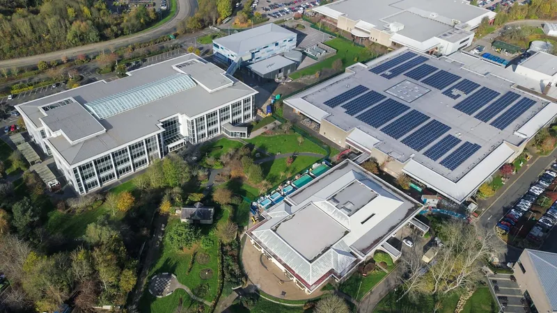
Valley-floor mill stock
Long stone mills on the Colne, the Calder and the Hebble, broad shallow roofs, tight yards and a skyline set by the hillside opposite.

Alectrona
Commercial solar by areaLeeds has a page of its own, so if your building is in that district start there. This page is for the rest of the county: Bradford and Keighley in Airedale, Huddersfield and the Colne Valley, Halifax and the Calder, Dewsbury and the Heavy Woollen towns, and Skipton at the head of the same valley run. The valley a building sits in changes how a system above 50 kWp is surveyed, delivered and designed. We have not completed an installation anywhere on this page, so what follows is coverage, terrain and engineering rather than a local job count.
West Yorkshire is not one market. The eastern half of the county is a plain: the Aire Valley below Leeds, the M1 corridor and the ground running out towards Wakefield, where a large roof sits in an open yard on level land. The western half is a set of steep valleys cut into the Pennine flank, where the mills were built beside the water that drove them, the towns climbed the sides above them, and the road, the canal, the railway and the electricity network all share the same narrow floor. The two halves want different conversations.
Leeds has its own page and holds the eastern argument, along with Wakefield and Castleford. This page belongs to everything else: Bradford and Keighley on the Aire, Huddersfield and the Colne Valley, Halifax and the Calder, Dewsbury and the Heavy Woollen towns, Skipton at the head of Airedale, and the shelf of newer estates along the M62 above all of it. We have not completed an installation in any of them, and no page here will imply otherwise. What we bring instead is a survey that comes to the roof, a design modelled against your own consumption, and an access plan worked out before anyone quotes a crane.
Every design starts on the roof rather than on a satellite image, and in these valleys the flight earns its keep twice over. Our drone pilot is in-house, insured and qualified to A2 CofC and GVC standard, and flies the building to produce a measured 3D model of the real surface: the pitches, the parapets, the rooflight runs, the plant, and the usable area once all of that is taken out. On converted mill stock that also means the condition of an older covering gets read without anyone walking a fragile roof to find out.
The second output is the one a flat-county survey never needs. The same flight captures the horizon from the roof itself, so the valley side opposite goes into the PV*SOL model as a measured skyline rather than a guess, and the generation figure comes back with the winter losses in the hours they actually fall. The flight also tells us something about access before we ever price a lift, because a yard too tight to launch and recover a drone comfortably is a yard worth thinking hard about before a crane is booked.
Take the routing first, because it decides which page is worth your time. If the building is in Leeds, Wakefield or Castleford, the Leeds page covers it, and it is written around the mechanics of delivery from the city we work out of: how quickly a surveyor is on the roof, how many revisits are practical, who attends commissioning. Everything else in the county is here, Bradford district included.
One thread runs through all of it and is deliberately not repeated on every block below. On stone-built mill stock the structural read comes before the electrical design, because a heavy covering does not mean a strong roof. It means the structure was designed close to its limit for the load it already carries, and what remains above that is calculated rather than assumed. That argument travels: a converted mill in Milnsbridge or Sowerby Bridge raises exactly the same questions as one in Manningham or on Dalton Lane, so we set it out once and apply it everywhere. Our guides on asbestos on older roofs and working at height under CDM 2015 cover the two hazards that arrive together on the same generation of sheeting, because a rooflight painted over in 1970 and a fibre-cement sheet beside it look identical from above.
The contact route is identical wherever the roof is. One enquiry form, the same surveyor and the same drone pilot, and no difference in how a job is run between the districts.
West of a line through Brighouse the county tips up. The Colne runs down from Marsden through Slaithwaite and Milnsbridge into Huddersfield, the Calder comes east from the Pennine watershed through Hebden Bridge, Mytholmroyd and Sowerby Bridge, the Ryburn drops in from Ripponden, and the Hebble Brook comes down through Halifax to meet the Calder at Salterhebble. The valley floors sit somewhere near 100 metres above sea level. The moor edge above them runs past 400, and the M62 crosses the tops between junctions 22 and 24 at a height no other motorway in England reaches.
That geography put the buildings where they are. Water power came first, so the mills went to the river, on the flattest strip of a valley that has very little flat ground. The canal followed the same line, then the railway, then the main road, and the result is a floor two or three hundred metres wide carrying five things at once, with the works packed against each other and the hillside starting immediately behind. Later industry climbed out onto the shelf near the motorway, which is why the modern steel-portal stock and the nineteenth-century stone stock in these towns are several hundred feet apart in height as well as a century apart in date.
Three practical consequences follow, and the rest of this page works through them in turn. Getting plant, panels and lifting equipment to the building is a real piece of engineering rather than a line item. The horizon around the array is not flat, so the generation model has to be built against the actual skyline rather than an almanac. And the electricity network follows the valley floor like everything else, so where your supply comes from depends on where in the valley you sit.
Huddersfield carries the highest manufacturing output density in West Yorkshire, and a striking share of that roof area is still generating nothing. Two industries dominate. Chemicals sit at the eastern end of the town, along the Leeds Road and Turnbridge corridor where the Colne joins the Calder valley, and out west towards Milnsbridge, on process sites that run plant continuously rather than to a working day. Precision engineering and toolmaking, descended from the textile-machinery trade that once supplied every mill in the county, are spread across the Bradley and Leeds Road estates in HD1 and HD2 and through sub-divided units further up the valleys.
The Colne Valley proper begins at Milnsbridge and runs west-south-west through Golcar, Linthwaite and Slaithwaite to Marsden, where the canal and the railway both disappear into the Pennines at Standedge. The mills along it are mostly independent manufacturers now, many in one or two bays of a building that used to be a single works, and a good number already carry solar from the Feed-in Tariff years, fitted when the incentive made the case easy and left without support when the firm that installed it moved on. Those arrays are the most common reason we get called into the valley at all.
Sector and shift pattern matter more than roof area when we size any of it. A continuous chemical process draws through the night, when nothing is generating, so an array covers a slice of a much larger bill and the case rests on that slice being reliable. A single-shift engineering unit that starts at seven and stops at four is generating and consuming in almost the same hours, a much closer match on a much smaller total. Both are worth doing, they are not the same design, and we read which one a building is from twelve months of its own half-hourly data rather than from the sector it files itself under.
Halifax sits in a bowl where the Hebble Brook comes down off the moors to meet the Calder at Salterhebble, with Beacon Hill rising sharply east of the town centre and Southowram and Northowram on the tops above it. The single largest run of commercial roof in the district is Dean Clough, a 22-acre former carpet mill in the Hebble valley just north of the centre, sixteen Victorian mill buildings now holding more than a hundred organisations and around three thousand people. It is one address and a great many roofs, meters and occupiers, and the tenure question that comes with that is set out on our offices and landlords page rather than repeated here.
The town’s manufacturing sits above and below it. Confectionery has been made at Albion Mills on Bailey Hall Road, HX3 9XT, for more than eighty years, on a multi-shift production and warehousing site tucked into the valley side east of the centre. Up on the tops at Southowram, West Lane Works in HX3 carries stone and concrete building-products manufacturing with hardstanding and shed roof to match. Down on the floor at Salterhebble, Calderdale Royal Hospital runs the continuous demand an acute site always does. Three roofs within two miles of each other, at three different heights, with three different skylines.
West of Halifax the valleys narrow again. Sowerby Bridge sits where the Ryburn joins the Calder, with Ripponden and Rishworth climbing towards the M62 at junction 22, and Mytholmroyd and Hebden Bridge strung along a floor barely wider than the river, the railway and the road together. Mills there were built to the water’s edge, and several have been flooded, most recently and severely at the end of 2015. That is a design input rather than a talking point: on a valley-floor building the inverters, the switchgear and the monitoring hardware want to sit above the level the water has previously reached, and where the only plant room is the one that flooded, the design has to solve that before anything goes on the roof.
Dewsbury is the largest town of the Heavy Woollen District, the cluster that also takes in Batley in WF17, Heckmondwike in WF16, Mirfield in WF14 and Cleckheaton to the north. The name comes from the cloth: heavyweight woollens, and above all the shoddy and mungo trades, which pulled worn garments and rags back into fibre and rewove them. That was recycling as an industry a century and a half before the word was used that way, and it built a stock of long stone mills with broad, shallow-pitched roofs and generous floor plates, most of them now in mixed manufacturing, storage and light-industrial use.
What sits on those roofs today is genuinely local. Mill Street West Industrial Estate off Anchor Bridge Way in WF12 is a secure steel-portal multi-let close to the town centre, about four miles from junction 40 of the M1 and five from junction 28 of the M62, and carpet manufacture continues on Calder Bank Road nearby. The A652 corridor running north through Batley Carr into Batley is a long-standing centre for bed, mattress and divan manufacture, which means a run of mid-sized sheds with day-shift assembly, extraction and compressed air behind them. Storage and haulage for the textile and carpet trade fills much of the rest, including bale warehousing off the M62, and one large third-party logistics shed at Shawcross is on its way out of use rather than into it.
Topographically this is the gentlest part of the page. The Calder here is wider and lower than it is above Brighouse, so a Dewsbury roof rarely has the skyline problem a Colne Valley roof has. The constraint is the yard instead: mills built tight to the river, the railway and each other, on street patterns laid out for carts. The town centre is mid-regeneration under the Towns Fund, with the Pioneer House skills centre and a Townscape Heritage programme working on the landmark buildings, and those central roofs are a different job from the estates on the edge of town.
Bradford district is the fourth valley on this page and the largest single block of commercial roof on it. The city divides into roof types more cleanly than it divides into postcodes. BD1 holds the Victorian merchant warehouses of the Little Germany quarter, tall and narrow with small roof plates, where the arithmetic rarely works at this scale however good the building. Manningham in BD8 holds the opposite extreme, the district’s largest single mill roof plates, alongside the wholesale and cash-and-carry belt running out along Thornton Road: single-storey, large-plate and lightly shaded, over a load that runs through the working day on lighting, dock equipment, pick operations and small power.
Much of the district is not a mill at all, and on that part the work is unremarkable in the best sense. The Canal Road corridor running north out of the centre towards Shipley is largely light-industrial and trade stock, much of it rebuilt in the past forty years. Laisterdyke and Bowling Back Lane in BD4 carry manufacturing and distribution on steel-portal frames, and the estates off the M606 spur give the district a motorway-facing shed typology identical to anything on the M62. That difference matters for programme rather than for price. A portal-frame unit off the M606 can move from survey to a costed design quickly; a converted mill in BD1 cannot, because the structural read and the access design both sit before the costed design rather than after it, and we would rather set that expectation than have it arrive as a delay.
Upstream the valley carries the same stock at a smaller grain. Keighley’s mills and works are generally smaller in plan and mostly single-occupier or lightly sub-divided, so the metering puzzle that dominates a Bradford conversion largely disappears, while the structural question does not. Downstream at Shipley and Saltaire in BD17 and BD18 the corridor carries a further constraint, because Saltaire is a World Heritage Site, which puts that model village and its mill in a different consent category from anything else in the district and is a matter for our planning permission guide rather than for a coverage page. Beyond Keighley the Aire runs on into Craven and the stock thins into the Skipton estates, which is why Skipton is covered here rather than on a page for a city it has no valley in common with.
On a modern estate this is not a subject. There is a yard, a level standing, a gate wide enough for an articulated lorry, and the crane goes where you point it. In a valley-floor mill it is frequently the hardest part of the job, and it is the part most often discovered late. The approach may be a single-track lane between stone walls with no passing place, through an archway built for a horse and cart, into a setted yard that slopes towards the goit. The bridge on the way in may be a canal or river crossing with a weight limit, and the railway arch after it may have a height restriction that a curtain-sided trailer does not clear.
So we survey the route as well as the roof. Can a 44-tonne artic physically reach the gate, or do the modules transship to rigid vehicles at a yard further down the valley. Is there a standing for a mobile crane with room for its outriggers, and is the ground under it made ground over a filled mill race, in which case it needs mats and a bearing check rather than an assumption. If there is no standing at all, does material go up by telehandler from the lane or through the building, and what does that do to the programme. If the only viable position is the public highway, the answer involves a road closure and the council rather than a crane hire.
Two constraints particular to these valleys are worth naming. The lane into the yard is usually also the way the workforce arrives, so deliveries get booked around shift changes rather than around the driver’s schedule. And the gradient matters: several of these approaches are steep enough that a loaded vehicle cannot restart on them in the wet, which decides the delivery vehicle before anything else does. Access, lifting and sequencing form part of the pre-construction information under CDM 2015, and we would rather settle them at survey, when they are a planning question, than on the morning a crane is standing in a lane it cannot turn in.
Long stone mills on the Colne, the Calder and the Hebble, broad shallow roofs, tight yards and a skyline set by the hillside opposite.
Chemicals along the Leeds Road and Turnbridge corridor and out towards Milnsbridge, with precision engineering on the Bradley and Leeds Road estates.
Steel-portal distribution, trade counter and engineering units at Ainley Top, Cooper Bridge, Armytage Road in Brighouse and Lowfields in Elland.
The Dean Clough mill complex at Halifax, the university campus on the Narrow Canal, and the acute hospital sites at Lindley and Salterhebble.
The Thornton Road wholesale belt and the Canal Road, Laisterdyke and M606 stock in Bradford, with the Dalton Lane and Steeton engineering works upstream.
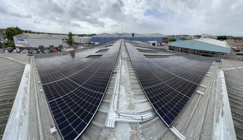
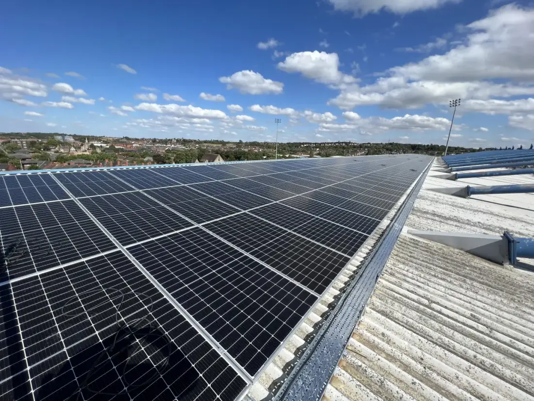
An annual yield figure assumes a horizon. On flat ground that assumption is close enough to true. In the Colne or the upper Calder the ground opposite your building can rise 150 metres inside a few hundred metres of horizontal distance, so the sun clears your skyline well after it has risen and drops behind it well before it sets. The array is not shaded in the usual sense, by a chimney or a taller neighbour, but its day is shorter than the calendar says, and the shortening falls in exactly the months when generation is scarce anyway.
Which side of the valley you are on decides how much that costs. Both the Colne and the Calder run broadly east to west, so the ridge that takes generation is the one to the south. A mill on the north bank with the hillside behind it loses very little, because the hill sits where the sun never goes. The same building on the south bank, with the valley side rising in front of it, can lose most of the middle of a December day. Two works a quarter of a mile apart, identical roofs, materially different models, which is why we will not quote a yield for a valley building from a postcode.
The measurement is straightforward and it happens at survey. The drone flight produces a horizon profile from the roof itself, which goes into the PV*SOL model as a real skyline rather than a flat percentage deduction, so the loss lands in the hours it actually falls in. The design then responds: string layout follows the shading pattern rather than the tidiest roof geometry, module-level electronics or additional inverter trackers go where one row clears the ridge an hour before the row beside it, and on a flat mill roof an east-west layout often gives away less than the textbook suggests, because the southern sky has already been taken by the hill. Where the honest answer is that the roof yields less than you hoped, you get that as a modelled number early rather than finding it in the first winter.
Above the valleys there is a shelf, and that is where the county’s straightforward roofs are. Ainley Top and Lindley Moor sit at junction 24, Cooper Bridge at the confluence of the Colne and the Calder runs towards junction 25, Armytage Road at Brighouse in HD6 and the Lowfields estate at Elland in HX5 fill the ground between them, and the moor road climbs west past Rishworth to junction 22. The stock here is steel portal frame, wide-bay and single storey: distribution, trade counter, engineering and food units with clear roof planes, a yard you can bring a crane into and a skyline that is genuinely flat because you are on top of the hill rather than underneath it.
The trade is exposure. A building at the moor edge sits several hundred feet higher than the mills below it, on open ground with no shelter, and the wind and snow figures that feed the mounting design are not the ones a sheltered valley floor produces. That is a calculation rather than an obstacle, and it is done for the actual site rather than inferred from the postcode, because two sheds of identical span several hundred feet apart in height are not the same design case.
This shelf is also where the next generation of large roofs will land. Employment land is allocated around Cooper Bridge, where a gyratory improvement has been taken forward to open up access to junctions 24 and 25, and at Clifton on the Brighouse side. If you are building or fitting out on one of those plots, bringing the array into the build programme costs less than retrofitting it, because the cable routes, the plant space and the roof penetrations are decided once rather than twice. Our warehousing and logistics work is built around this kind of roof.
Northern Powergrid is the network operator for Bradford, Keighley, Huddersfield, Halifax and Dewsbury, and anything above 50 kWp connects under a G99 application to them. No constrained primary substation is on record for any of those towns, so we make no town-wide claim about headroom in either direction. In this terrain the position is established for the specific point of connection, because two buildings a mile apart in the same valley can sit on very different parts of the network. At the western edge of the page, in the far-outlying BD23 addresses beyond Skipton and up towards the Calderdale watershed, we confirm the distributor from the supply number itself, because that is where the licence area runs out.
In a valley the network takes the same route as everything else, which is the floor. The corridor that carries the river, the canal, the railway and the main road carries the cables too, so a mill on the valley bottom is usually close to a substantial feeder, while a works part-way up the side, or a site out on the moor-edge shelf, can sit at the end of a long spur built for a handful of houses and a farm. Two buildings in the same postcode district, a mile apart and 200 metres apart in height, can return very different answers on available capacity.
That is why we ask for the MPAN early and confirm the position for the actual point of connection rather than reasoning from the town. We do not assert a named constrained primary substation for Huddersfield, Halifax or Dewsbury, because there is none on record for these towns and inventing one to sound knowledgeable would be worse than useless. Headroom is a site-by-site question here, answered by the application rather than by a page.
Where it is tight, the answer is normally an export limitation scheme rather than a smaller array, chosen alongside the inverter rather than bolted on after an unwelcome letter, because retrofitting the metering and the controller into a finished design is how a commissioning date slips. On the western edge of Calderdale, up towards the watershed, we also confirm the operator against the supply itself rather than assuming it from the county. Our guides to the G99 application and G100 export limitation set out what each stage asks for, and we lodge and correspond on both rather than leaving them with your team.
The city divides into roof types more cleanly than it divides into postcodes. BD1 holds the Victorian merchant warehouses of the Little Germany quarter, tall and narrow with small roof plates, where the arithmetic rarely works at this scale however good the building. Manningham in BD8 holds the opposite extreme, the district's largest single mill roof plates, including the Grade II* listed complex at Lister Mills, alongside the cash-and-carry and wholesale belt running out along Thornton Road. Listerhills in BD7 mixes science-park and university buildings on the western edge of the centre, and BD9 carries the acute hospital estate at Duckworth Lane, with a second acute site south of the centre.
East and south the stock turns industrial, BD3 and BD4 running manufacturing and distribution on a mixture of steel-portal units and mid-century sheeted bays, with the Canal Road corridor north towards Shipley in BD17 and BD18 carrying light-industrial and trade stock much of it rebuilt in the past forty years. The whole district, Keighley included, sits under one planning authority, which at least means one set of conventions to learn rather than several. The regeneration funding that followed the 2025 City of Culture year has also been pulling parts of the estate into refurbishment cycles, which is the moment a roof array is cheapest to design in. On the mid-century sheeted bays in BD4 and BD5 the covering is the first question rather than the last, and our asbestos guide sets out which survey that needs.
Keighley is an engineering town with a textile inheritance, and the two show up as two different roof problems on the same street. BD21 covers central Keighley and Riddlesden, including the industrial boiler works on Parkwood Street and the valley-floor stock along Dalton Lane, where Providence Park has brought modern portal-frame units onto the former Universal Mills plot, part-funded through the Keighley Towns Fund and with a college engineering hub on the same site. BD20 runs north-west through Steeton and Silsden, where access-equipment manufacture keeps a substantial assembly and distribution footprint. BD22 climbs the Worth Valley through Oakworth, Haworth and Oxenhope, where the works are older, smaller and set in tight valley bottoms with far less roof plate per building.
The commercially useful point about Keighley is the load shape rather than the roof. Fabrication plant, compressed air, extraction and assembly lines draw steadily through shift hours, which is the demand pattern that lets generation be used on site instead of exported, and it beats landlord services on a converted mill by a wide margin. Proposals have also been made to redevelop the Aire Valley Business Centre on Lawkholme Lane in BD21 with new warehouse and office units while retaining the existing Airedale Mill building, which if it proceeds would add further modern roof stock to a town that has not had much of it. Nothing on this page claims that scheme as built.
Skipton is the top of the Airedale run this page follows, and it is the one town here that is not in West Yorkshire. It sits just outside the Yorkshire Dales National Park with much of its hinterland inside it, so two planning authorities operate within a few miles of the town and which one determines a site is a question of the boundary rather than of the address. The town also sits towards the western edge of the Northern Powergrid Yorkshire licence area, and some far-outlying BD23 addresses can fall instead to the neighbouring operator, SP Electricity North West (formerly Electricity North West). We confirm the distributor from the site's own supply number rather than from the town name, because otherwise the connection application goes to the wrong body and the clock starts again. The town core and its estates are firmly Northern Powergrid.
The established industrial stock is Snaygill Industrial Estate on Keighley Road, with surface-finishing, metal-pressing and civil-engineering occupiers and Union Business Park within it, mostly 1970s and 1980s factory and trade-unit roofs. The newer space is at Wyvern Park on the town edge, an employment-led scheme of around 250,000 square feet of industrial and office units, and at Broughton Hall Business Park, a country estate outside the town carrying fifty or more companies in converted and purpose-built office and workshop space. Acorn Business Park adds detached offices, and a building society head office at The Bailey on Harrogate Road is one of the largest single daytime loads in the district. Confectionery has been manufactured in the town for close to a century.
The load worth singling out is the auction mart on Gargrave Road. A livestock market concentrates its demand into market days: heavy lighting, ventilation, handling and catering loads on one or two days a week and very little between them. It is the sharpest illustration on this page of why an annual consumption total is a poor basis for sizing, because the same total spread evenly across the week would justify a completely different system and a completely different view on storage.
Huddersfield’s commercial roof stock reads district by district, and the districts follow the contours. HD1 is the town centre and the Leeds Road and St Andrew’s Road corridor running north-east along the valley floor, the flattest and most accessible industrial ground in the town, and it also holds the university campus packed along the Huddersfield Narrow Canal, where teaching, laboratory and library buildings draw straight through the working day. HD2 climbs north through Bradley and Fixby towards Ainley Top, which is where the estate stock starts to look like the modern shelf rather than the old valley. HD3 covers Lindley and Milnsbridge on the western slope, with the Royal Infirmary at Lindley running the continuous demand of an acute hospital site.
South and east the ground rises again. HD4 takes in Lockwood and Newsome above the Holme, HD5 covers Dalton and Almondbury on the eastern side, and both carry smaller engineering and trade units on cramped sites where access decides more than roof area does. HD7 is the Colne Valley itself, Golcar, Linthwaite, Slaithwaite and Marsden, a long thin district of independent manufacturers in sub-divided mills, the steepest skylines on this page and the densest concentration of ageing Feed-in Tariff arrays we get asked to look at. Kirklees Council determines applications across all of them.
Halifax is the principal town of Calderdale, and its districts stack up the sides of the bowl the town sits in. HX1 is the centre on the valley floor. HX2 runs up the northern hillsides through Illingworth, Ovenden and Mixenden and out west towards Luddendenfoot, ground high enough that the exposure figures start to matter. HX3 is the eastern and northern shoulder: Boothtown and the Dean Clough complex in the Hebble valley, Northowram and Southowram on the tops with the stone and concrete building-products works at West Lane, and the confectionery site at Albion Mills on Bailey Hall Road tucked below them.
South and west the valley reasserts itself. HX4 covers Greetland, Stainland and Holywell Green on the slopes above the Calder, HX5 is Elland on the valley floor near junction 24 of the M62 with the Lowfields estate stock, and HX6 is Sowerby Bridge at the Ryburn confluence and up the Ryburn towards Ripponden. Calderdale Royal Hospital sits at Salterhebble where the Hebble meets the Calder. Calderdale Council is the planning authority throughout, and across the district the practical divide is not the postcode but the height: a floor-level mill has an access and a flood question, a moor-edge building has an exposure question, and very few sites in this borough have neither.
Dewsbury divides cleanly in two. WF12 holds the eastern side, Thornhill, Savile Town, Earlsheaton and Shawcross, and with it most of the working industrial ground: the Mill Street West estate off Anchor Bridge Way, the carpet manufacture on Calder Bank Road, and the storage and haulage yards that serve the textile trade off the A638 and the M62. WF13 covers the town centre and Ravensthorpe to the west, where the mills sit tight against the Calder and the railway, and where the older stone stock with its long shallow roofs is most concentrated.
The load underneath is what makes the town worth surveying. Bed, mattress and divan assembly along the corridor towards Batley, carpet and fibre work in the surviving mills, and multi-let steel-portal units running compressed air, extraction and lighting through a single day shift, all of it generating demand in the hours an array produces. Dewsbury station sits on the Leeds to Huddersfield and Manchester main line, and the M1 at junction 40 and the M62 at junction 28 are both within a few miles, which is why so much of the district’s floor area is storage rather than production. Kirklees Council is the planning authority, the same as Huddersfield, so an application from either town follows the same route.
How a large flat-roof distribution-centre array is sized to a daytime logistics load, using half-hourly modelling, an in-house drone survey and an export-limited design.
Read the worked exampleHow a stadium stand roof is matched to an event-driven load, where the heaviest demand falls in the evening and the load model decides whether storage earns its place.
Read the worked exampleThere is no price for these towns and we will not publish a per-kWp figure, because in this part of the county two identical roofs can price very differently. The things that move the number are the ones we measure on the day: the usable roof area once plant, rooflights and parapets are taken out, the modelled yield against your actual skyline rather than an assumed one, the inverter and any export-limitation equipment, and the access and lifting plan, which on a confined valley-floor yard is a real cost and on a shelf estate near the motorway is close to nothing.
The figure therefore comes out of the survey and the model, not a rate card, and it arrives with the design that justifies it. What does not move it is where in Yorkshire the building is, because there is no travel loading in it to begin with.
The connection usually sets it. Above 50 kWp the G99 application is the longest single item in most programmes, so we lodge it early and run it alongside the design rather than after it, and we draw the design so it is buildable whether or not an export limit comes back. That way the project is not waiting on a letter to know its own shape.
The second item, and the one specific to these valleys, is access. If the crane standing needs mats and a bearing check, if modules have to transship to rigid vehicles, or if a lift can only happen with the lane closed, those are lead times to book rather than problems to solve on the day. We settle both at survey and give you a programme for your building rather than an average.
Yes, and by the same people. Bradford, Keighley, Shipley, Saltaire and the Airedale corridor are covered on this page, with their postcode districts, their planning authority and the detail of what is on their roofs set out in the covered towns section rather than on a page of their own. Skipton at the head of the same valley is here too, though it is determined by North Yorkshire Council and its block says so.
The structural argument that page was built around has not gone anywhere either. It moved to the guides, where it belongs, because a heavy covering does not mean a strong roof anywhere in this county and it was wrong to file that under one town. Use the Leeds page for Leeds, Wakefield and Castleford; everything else in the county is here, on the same enquiry form and with the same surveyor and drone pilot.
It depends almost entirely on which bank you are on, and it is measurable rather than a matter of opinion. Because the Colne and the Calder run broadly east to west, the valley side that matters is the one to the south. A building on the north bank with the hill behind it loses very little, since the hill occupies sky the sun never crosses. A building on the south bank with the valley side rising in front of it loses the start and end of every day, and in December a good part of the middle as well.
Rather than apply a percentage, we capture the horizon from the roof during the drone flight and put it into the PV*SOL model as a measured skyline, so the loss appears in the hours it genuinely falls in and can be read against your own consumption. If the roof is worth less than you were hoping, you get that as a number before you spend anything.
Usually, but only once someone has looked properly, which is why we survey the route as well as the roof. The questions are whether an articulated lorry can reach the gate or the modules need transshipping to rigid vehicles, whether there is a level standing with room for crane outriggers, and whether the ground under it is made ground over a filled mill race, in which case it takes mats and a bearing check rather than an assumption. Weight-limited bridges and low railway arches on the approach get checked at the same time.
Where there is no standing at all, material can go up by telehandler from the lane or through the building, and where the only viable position is the public highway, the answer involves the council and a road closure rather than a crane hire. That work belongs in the survey and the price, not in a phone call on the morning of the lift.
Yes. Brighouse in HD6, Elland in HX5, Batley in WF17, Mirfield in WF14 and Heckmondwike in WF16 are all inside the coverage of this page, and a survey there is booked on exactly the same terms as one in Huddersfield or Halifax. The three towns with their own detailed blocks above are the ones that previously had separate pages, so their postcode districts and planning authorities are set out in full for the search queries that used to land there.
Two practical differences are worth knowing. Brighouse and Elland fall under Calderdale Council while Batley, Mirfield and Heckmondwike fall under Kirklees Council, so the determining authority changes across the boundary even where the building type does not. The network operator does not change, so the connection is handled identically throughout.
Last updated August 2026
Wherever you are in the region, the on-site drone survey comes to you and the PV*SOL model sets the figure. Send us the site and the half-hourly load, and we will come back with a designed system.